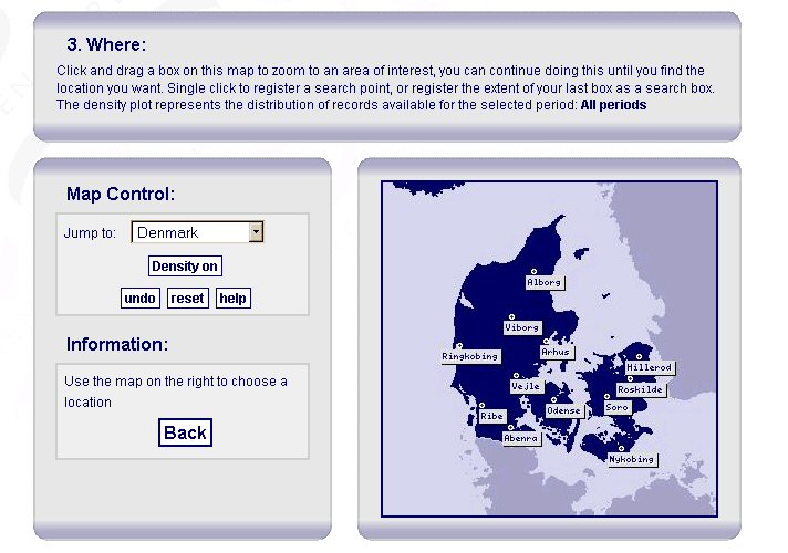
Figure 3: Screenshot demonstrating the ARENA Where search, looking at Denmark
The ARENA portal search interface was designed to allow users to build a search query using the classic what, when and where combination. The spatial aspect of the interface was built to allow the user to choose a geographic area in which to search for records. The ARENA portal makes use of an open source web-GIS interface to allow the user to select 'Where' coordinates by using map navigation.

Figure 3: Screenshot demonstrating the ARENA Where search, looking at Denmark
The user sees a map and a map control box as shown in Figure 3. Clicking the mouse once anywhere on the map selects a single point and re-centres the map around the chosen point. A red crosshair indicates the exact position. Upon selection, the information box to the left of the map displays the chosen coordinates and provides the user with the option to 'Store Value' and appends the query.

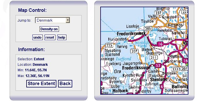
Figure 4: Screenshot demonstrating the ARENA Where search, looking at the area around Frederikssund in Denmark
It is also possible for the user to select a more precise location than is attainable with the initial view (see Figure 4). This is achieved by performing a 'click-hold-drag' mouse action to draw a bounding box around the desired area of the map. In the case illustrated in Figure 4, a box was drawn around the Frederikssund area in Denmark. On release of the mouse button the map redraws itself, centred and scaled to the updated bounding coordinates. This action can be repeated until the zoom level reaches a 'street-map' level. To zoom out, one can either make use of the 'Back' button on the browser to step back through previous views, or click the 'reset' link to rescale and re-centre the map to the initial view.
To pan around the map, the user can perform multiple single clicks to re-centre the map without zooming.
To jump to partner-specific regions, a drop-down list has been created that contains stored coordinates for the relevant countries. Choosing from this list will re-centre the map around the selected country, from which point one can either zoom, pan, or click and store a new coordinate.
Once a selection has been stored and the query updated, the final search query will be configured to perform a search of records that lie within a set number of kilometres of the chosen location.

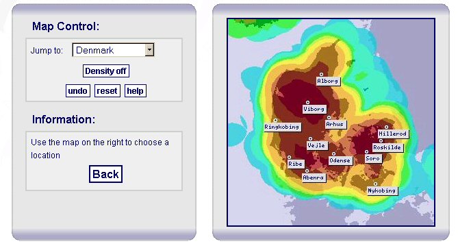
Figure 5: Screenshot demonstrating the ARENA Where search, showing record density for all periods in Denmark
As the ARENA project contains data from certain parts of Europe only, there needs to be a way of indicating where records can be found. To do this the user can also view density plots representing records relevant to the chosen 'When' period. For example, the user can select and view the density of Iron Age sites in Denmark. If no 'When' period has been chosen, the density plot represents records covering all periods as seen in figure 5 above. This density layer can be turned on/off by clicking on the 'Density on/off' link.
© Internet Archaeology/Author(s)
University of York legal statements | Terms and Conditions
| File last updated: Tue Sep 27 2005