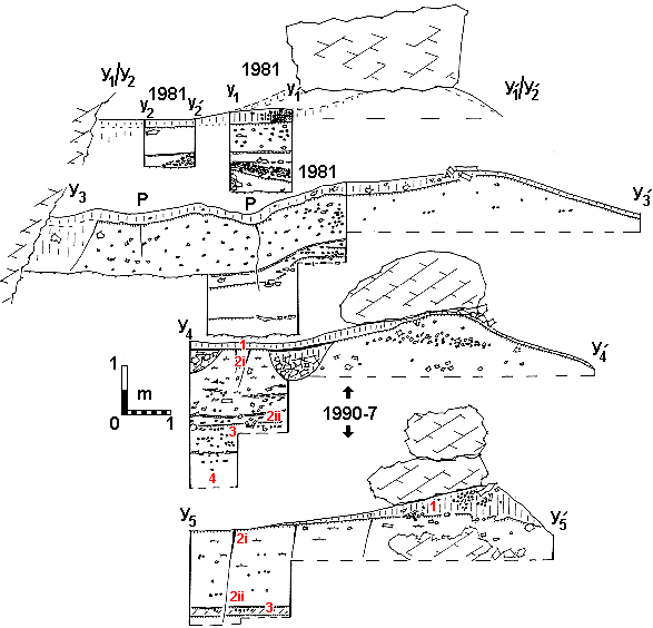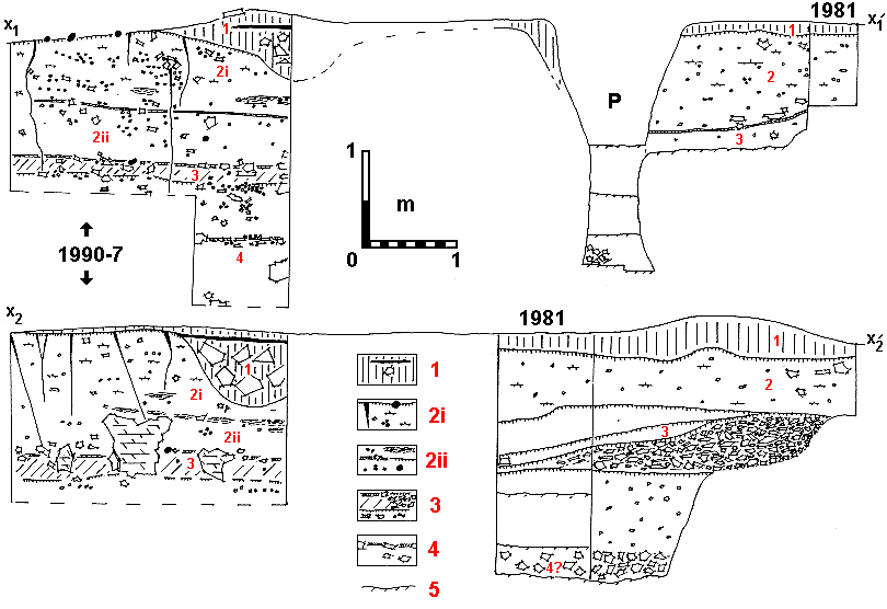
The synoptic sections take advantage of exposures visible in the deep, post-Civil War hide-away pit and its 1981 archaeological exploration. Note, also, raised soil pediments that had been preserved by the overlying boulders they supported, fallen from the cave roof. In order to orientate the sections on the ground plan, x-x and y-y indicators should be read as in Figure 3a.
| Numbered as in Figure 3, stratigraphical units are: | |
|---|---|
| unit 1 | powdery dark-grey soil (Munsell hues 10YR5/3-10YR7/4) |
| upper unit 2 (2i) | yellowish soil (Munsell hues 7.5YR7/4-7.5YR8/6) apart from diffuse reddish brown (lateritic?) lenses, comprising eroded sand and bioclasts from the cave roof and 15% of löess-size particles showing pitted surfaces, all interrupted deep retraction fissures |
| lower unit 2 (2ii) | |
| unit 3 | yellowish soil (Munsell hues 7.5YR7/4-7.5YR8/6), sometimes greyish with 10-15% löess-size wind-blown particles, interrupted by erosion surfaces and scree |
| unit 4 | beginning with small broken calcrete slabs covering soils similar to the preceding unit |
| unit 5 | unexcavated, allochthonous cobbles are shown as black spots |
| P | deep, post-Civil War hide-away pit |
| Other features shown include fallen blocks, retraction fissures extending down from the eroded surface of unit 2, older eroded surfaces, calcretes, scree and (hachuring) grey soil of unit 3. | |

