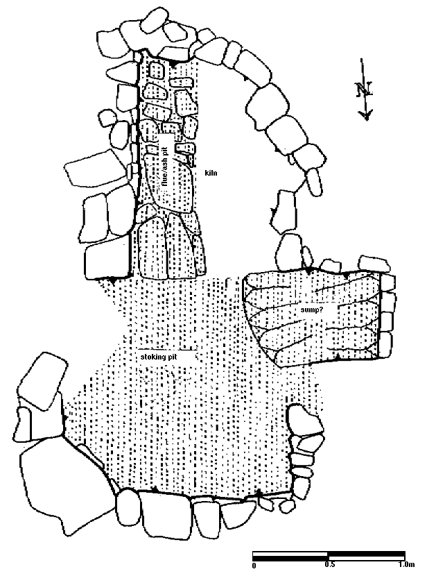
Excavated in 1988 by the Archaeological section of the Waterford Corporation. The excavation report has not yet been published. A site plan of the kiln at the scale of 1:20 has been made available by the senior archaeologist Orla Scully. The figure is traced from this plan taking into consideration additional information supplied upon request. The kiln had been partially destroyed, in its south eastern quarter (top left of figure), by the construction of a later well. The paved section of the sunken area is interpreted as a flue/ash pit. To the right of this there was no change of level to, what is described in the excavation record as, a 'brown clay floor'. To the north, the stoke pit is described as a 'blackened clay floor'. In the overlaying stratigraphy the undelineated edge between the flue/ash pit, stoke pit and south west quarter of the kiln is duplicated in a definite edge to a black deposit of 'cinders, charcoal, ash etc.' (see Appendix 5 Figure 118). The V sectioned pit extended downwards 0.9m below the sunken floor. This may possibly represent a drainage sump similar to the one occupying a similar position in the kiln from Arundel Square (Figure 55). Pipe reinforced muffle material similar to the English norm covered the stoke pit floor. Pipes from the kiln have been dated by Sheila Lane of the Department of Archaeology, University College, Cork, to the second half of the eighteenth century.