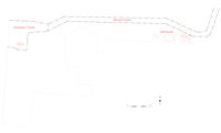
Figure 4: Location of evaluation trench, service trench and watching brief burials
An evaluation trench was located over the footprint of the proposed substation building, and a 3m wide projection was centred on the proposed route of the service trench across the chapel yard (Fig. 4). The trench measured c. 6.50m north to south by 4.00m east to west. The service trench extension projected c. 4.50m east from the north-east corner of the proposed substation.
A brick lean-to building on the substation site had been demolished and cleared prior to commencement of fieldwork. This building had been constructed without foundations onto a sandstone slab surface contiguous with the main yard surface. In the area of the proposed substation this surface was at approximately 78.90m AOD. The sandstone slabs were removed by hand. One grave slab was also removed, corresponding to number 17 on the 1900 burial plan and number 12 in the gravestone survey, and retained for later repositioning. A mechanical excavator was then used to remove the underlying material, until the surface of the natural clay was reached. Finds of 13th- to 19th-century pottery, mid-17th- to late 19th-century clay tobacco pipe, glass, animal bone, shell and crucible encountered during machining were collected as unstratified (U/S) and derived from the made ground graveyard deposit (112) and the buried soil (100); the boundary between these deposits was indistinguishable during machining. Archaeological features were visible cut into the surface of the natural clay and these were hand-excavated (Fig. 5). A single grave cut [108] was identified and burials SK[1] and SK[2] were recovered.
A watching brief was maintained during the subsequent excavation of the service trench along the northern edge of the site, and during the minor reduction in ground level along the northern side of the Upper Chapel. During lifting of the slabs along the northern side of the chapel, a single grave slab was exposed that had previously been obscured by a layer of concrete and was included within the gravestone survey as Gravestone 40. Two grave slabs were removed during the ground reduction, corresponding to numbers 39 and 40 in the gravestone survey, and retained for later repositioning. Three graves were identified during the ground level reduction, and were surveyed in by EDM (Fig. 6). The fills were hand-excavated to the proposed reduction depth of 0.30m, but no burials were present within this depth. Re-routing of the service trench at the eastern end of the site appeared likely to impact upon one of the graves identified during ground-level reduction, and this area was targeted for hand-excavation. Two burials were encountered within the impact depth of 0.90m.
During the excavations, sequential context numbers were assigned to grave cuts, grave fills, skeletons, coffins, and walls or other structures. An inventory of the contexts and skeletons is presented (Table 2 and Table 3). The dates assigned to pottery and clay pipe are derived from the relevant specialist reports. The significance of the contextual record recovered lies in its evidence of stratigraphy, grave location, method of burial, skeletal position, and the location of coffin furnishings and grave goods.
© Internet Archaeology/Author(s)
University of York legal statements | Terms and Conditions
| File last updated: Wed Jan 19 2011