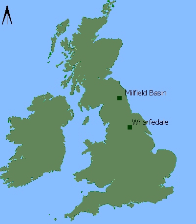
Figure 1: Map of Britain - showing location of study areas
In the process of developing expertise with Desktop VR, I have been investigating a number of landscape-related subject areas. These include sculpture parks, landscape-designed gardens and classic physical geography environments as well as landscape archaeology. However, for the purposes of this article only the work relating to archaeology will be considered. The specific choice of Atlantic rock art distribution was based on my own long-standing interest in this area of archaeology and art history (I have been photographing rock art for 25 years visiting most of the major concentrations in the British Isles and Brittany. Another factor was the proximity of many fine examples near to my home in Yorkshire, and in Northumberland, reasonably near to Teesside where I work).

Figure 1: Map of Britain - showing location of study areas
A number of early experiments were carried out in Yorkshire on Rombalds Moor and Snowden Carr overlooking Wharfedale and the Washburn valley respectively. Later work in Northumberland confirmed that a test area with a reasonably high concentration of carvings and well-defined boundaries was desirable to explore the techniques of 'nodal linking' i.e. linking scenes/panoramas together. The area around the Milfield Basin seemed ideal because a number of archaeologists have published recent work relating to just that region, discussing a range of topics that lend themselves to illustration with VR techniques (Waddington 1998; Bradley 1997).
It might be useful to discuss some aspects of current thinking regarding Atlantic rock art before discussing the two study areas in detail.
© Internet Archaeology
URL: http://intarch.ac.uk/journal/issue8/larkman/6.html
Last updated: Mon Sep 25 2000